There has been a lot of conversation in the Civil 3D community about large surface size.
One of the more common sources of large surface data files is aerial topography. Often, we are only provided with contours that have very close vertices. Sometimes we are able to get the DTM file or if we are really lucky the actual TIN or grid itself.
I have often had the experience of sitting down in an engineer's office and seeing what I would consider to be an unmanageablely large drawing. Upon inspection, aerial topography is the culprit.
I often recommend weeding the vertices of those contours before creating a surface from them and I am met with responses such as "we want to be as accurate as possible"
And I don't disagree with that. But I wanted to know exactly how much accuracy would be lost by doing a little bit of vertex elimination.
Here are some aerial topographic contours.
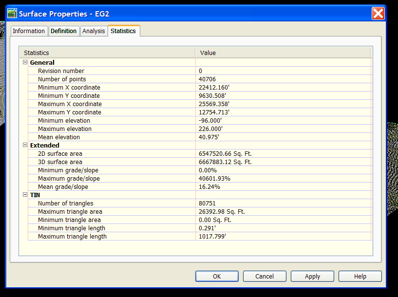
I built a surface from them "as is" called EG.
Then I weeded the contour vertices using the Map Cleanup>Simplify Objects command. I set the distance to 1ft.
Here are the results:
Drawing with nothing but EG surface in it: approx. 11 Meg
Drawing with nothing but EG1 surface in it: approx. 3 Meg
I made a flat surface at elevation zero to use as a comparison. I took a composite volume between EG and Flat, EG1 and Flat, and EG and EG1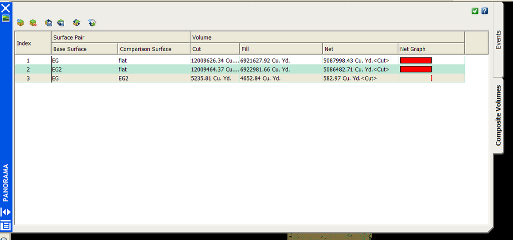
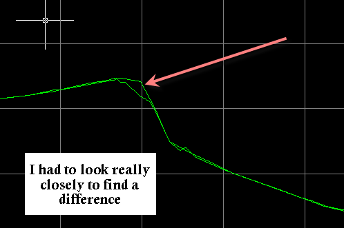
I also did a quick profile to see if there was a visible difference between the two surfaces. I did this a few places- here is just one of them. The results were similar- very few visible differences. And those that were visible were very small.
Here is a table of results comparing the two surfaces. (Note that you can click on it to see it larger).
Over the whole surface, 150 acres +/-, I discovered a difference of just about 3% in net volume.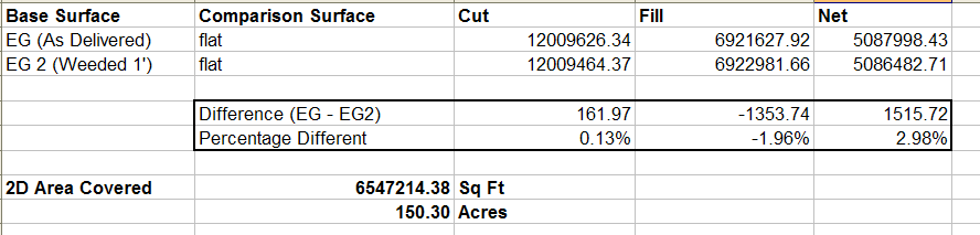
Is this significant? You tell me. You are the PE on the job.
But think about this: if those differences are not significant, you are bogging down your drawing with an unnecessarily large surface.
Also- consider that you can reduce the simplification factor. I did 1Ft. In the past I have worked with clients who used 0.5ft and it made enough of a difference in drawing size to make it worth it.
You be the judge- I'd love to hear your comments!!! Please let me know if I missed something here.
Thursday, August 03, 2006
How much surface is too much?
Posted by Dana at 12:20:00 AM
Subscribe to:
Post Comments (Atom)


2 Comments:
Dana,
Your last image show what looks like it might be in Excel. Is that cut/fill results in Excel? If so, how did you create that? I have done a cut/fill but can only see the results under the comparison surface.
Thanks,
Jason
Missed the point Dana.
The question is liability.
If you use an unedited surface from the supplier of that information they are on the hook.
If you edit it you own it.
Of course you are a party to the same suit but you can point a finger.
At least that is the answer we came up with a long time ago.
Post a Comment