The question came up on the Civil 3D discussion group today:
If I have an alignment
and a Surface
Can I make a table that pulls out the X, Y and Z at each station?
Here is one method- I am still working on another one, because you will see there are two minor annoyances.
1) Create a Surface Profile from your Alignment. You won't have to do anything with this, Civil 3D just has to think about your surface with respect to your alignment.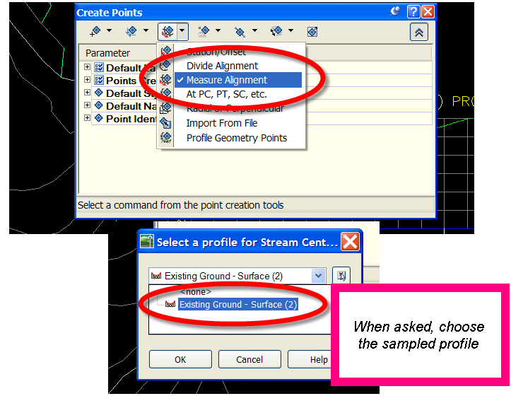
2) Points>Create Points. Use the Measure Alignment Option. Choose your sampled profile for the elevations. Follow the command prompts.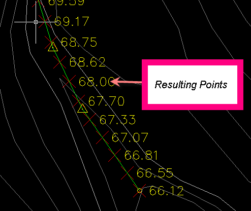
3) Make a Point Table style that shows Point Number, Northing, Easting, Elevation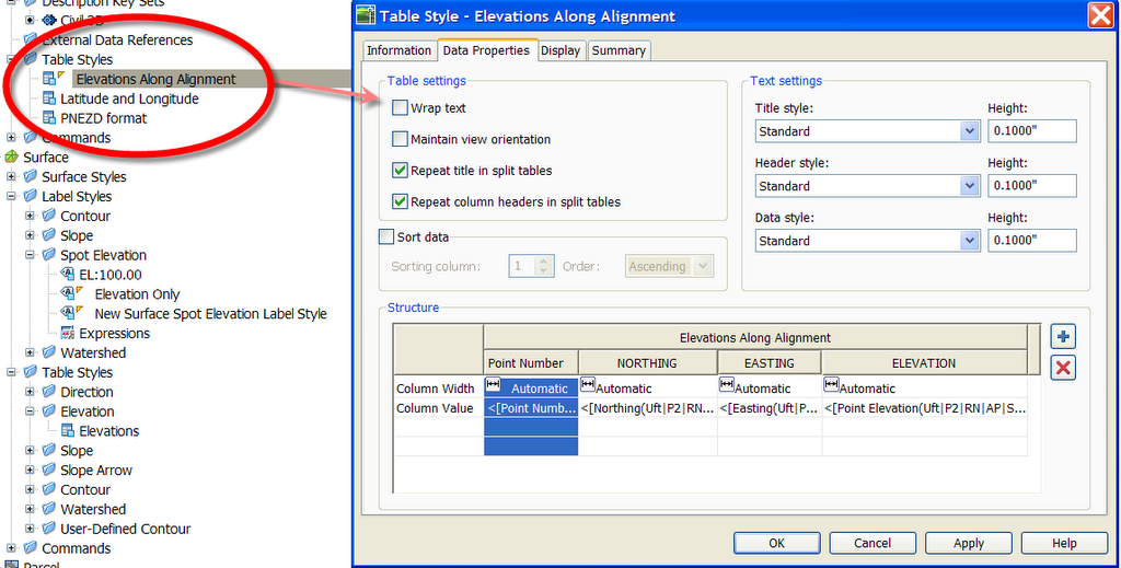
4) Make a Point Table
Annoyance #1
Points from a surface, unlike surface labels, are not instantly dynamic to the surface. Moving the point or changing the surface will not immediately update it. If your surface did change, you could always Points>Edit>Elevation from Surface. Once you do that, your points will update and your table will, too.
Annoyance #2
Points can't have references, so I can't (at press time) figure out a way to get the Alignment Station in the Point Table. It would be easy enough to just remember that Point Number 1 = Station 1+00, etc. but that bugs me. You could also name each point in the name column of the Prospector with its station, which is what I show below. If there were only a handful of stations, this is what I would do.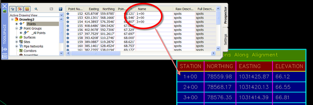
There are a few other things we can mess with here- involving excel, an autocad table, an empty roll of toilet paper and a small amount of nitroglycerin, so I will post an update later today. This one is better than Su Doku.
Saturday, August 19, 2006
Create a Table of X,Y,Z Coordinates from an Alignment: Method 1
Posted by Dana at 3:30:00 PM
Subscribe to:
Post Comments (Atom)


1 Comment:
Do you know how to put the Station in the point description?
ie.
POINT - 100
ELEV. - 200.000
DESC. - 0+300
Post a Comment